| offer status | aktualna |
| price | 3084000.00 PLN |
| bond | 3084000.00 PLN |
| tender | 2021-12-31 |
| location | Kortowo |
| street | Kalinowskiego |
| post code | 10-755 |
| property type | plot |
| area | 1.9588 ha |
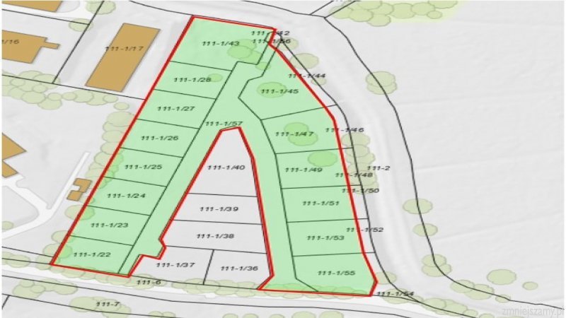
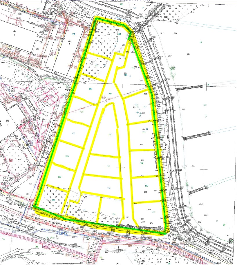
| plot number | 1/22, 1/23, 1/24, 1/25, 1/26, 1/27, 1/28, 1/43, 1/45, 1/47, 1/49, 1/51, 1/53, 1/55, |
| geodetic districts | 111 |
| mortgage register | OL1O/00079602/7 |
| MSIPMO | See details |
| BIP | See details |
The plot is located in the southern part of the city, in the suburban area. Kalinowskiego Street connects with Warszawska Avenue, the exit route no. 7 from Olsztyn towards Warsaw, leading from the Kortowo district to the city center. Kalinowskiego Street is connected to the city center and the University by bus lines.
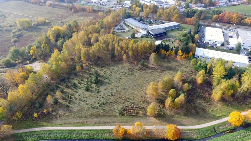
Kortowo is a district of Olsztyn known for university town located nearby (about 1 km from the plot), recreational areas, lakes: “Kortowskie” and “Starodworskie” (about 1 km from the plot),
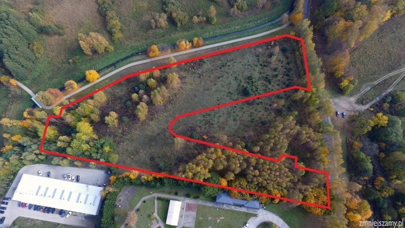
The shape of the property is irregular, similar to a triangle, the plot is divided into 20 geodetic plots, with areas from 904 sqm to 1,758 sqm, with an arranged A-shaped internal road and a located entry to the property (4,370 sqm).
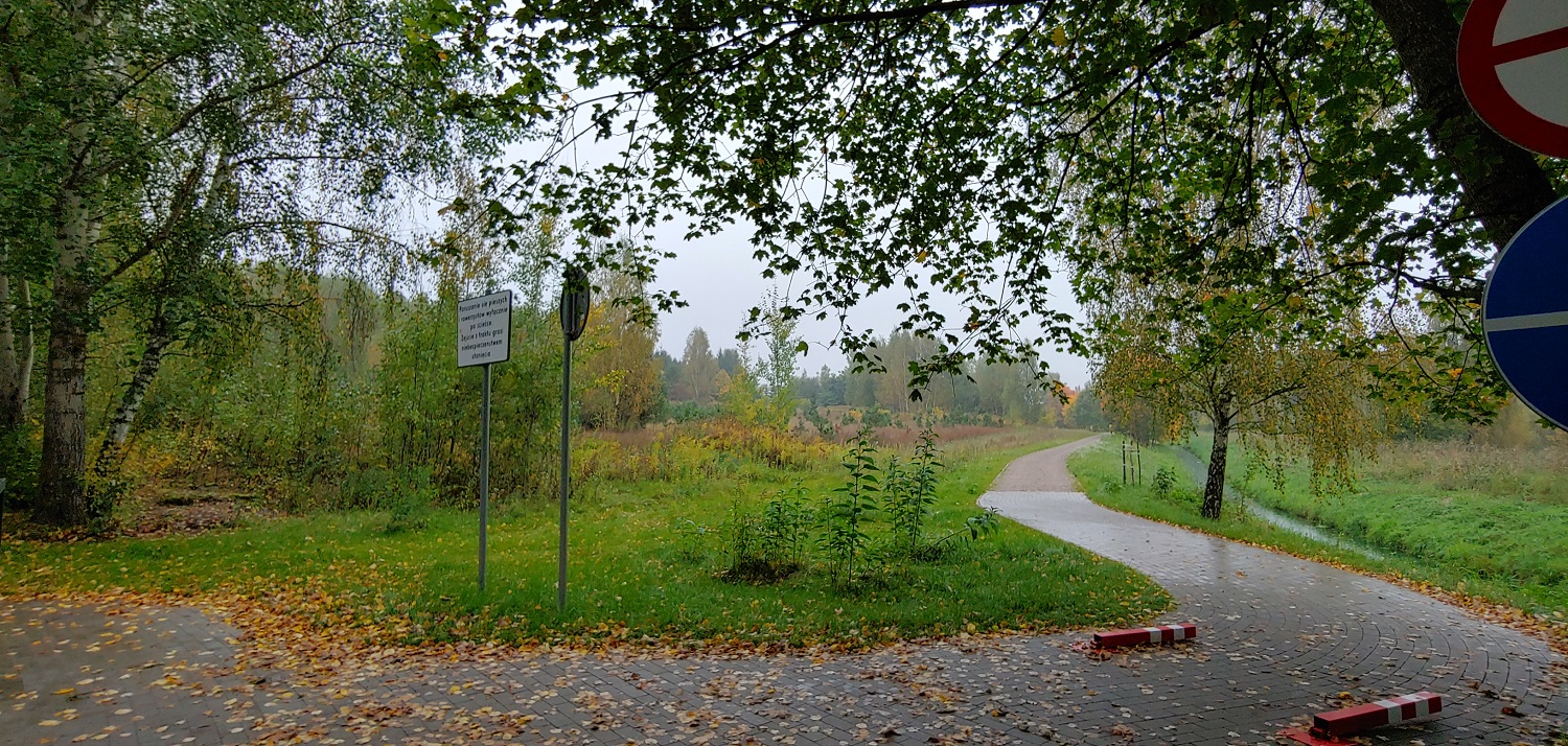
From the east and the north-east side, the plot is adjacent to the newly built cycle path "Łynostrada" which ends along the “Kortówka” River, from the west – to the plots of the Park Hotel and car salons, from the south – to Kalinowskiego Street.
The area is leveled, flat, with a slope to the east. Main seedlings of birch and poplar grow on the property.
The property is included in “The University of Warmia and Mazury in Kortowo” land development plan – adopted by the Olsztyn City Council Resolution No. XX/281/03 of 17.12.2003. According to the plan, the plots are marked as:
1) Plots no.: 1/22, 1/23, 1/24, 1/25, 1/26, 1/27, 1/28, 1/43, 1/45, 1/47, 1/49, 1/51, 1/53, – UT – basic land use associated with tourist services, location of administrative services along with accompanying trade service is allowed,
2) Plot no. 1/51 – UT – basic zoning related to tourist services, location of administrative services along with accompanying trade service is allowed,
3) NOp2 – planned local sanitary sewage pumping stations.
The plots are not located in the area of revitalization, they are not supported by a simplified forest management plan nor a decision specifying the forest management tasks issued based on the forests state inventory.
| technology park | No |
| the shape of the site | Triangle |
| current land use | wasteland |
| max. area available | 1.9588 ha |
| valid zoning plan | yes |
| owner type | state treasury, perpetual usufruct |
| SEZ | No |
| access road | 5 m paved road |
| differences in land level | 7,5 m |
| possibility for expansion | Nie |
| zoning |
basic function: tourist services possible function: location of administrative services along with accompanying trade services |
| owner | Energa Centrum Usług Wspólnych Sp. z o.o. |
| obstacles and ecological restrictions |
Archaeological site XV AZP 24 51/15 included in the voivodeship register of monuments located on the plots no.: /24, 1/25, 1/26, 1/27, 1/28, 1/40, 143, 1/45, 1/47, 1/49, 1/57 The provisions of Art. 31 of the Act of July 23, 2003 on the protection of monum |
| risk of flooding or land slide | no |
| distance to motorway |
A1: 150 km |
| distance to national road |
DK 51: 200 m |
| distance to railway station |
Olsztyn Główny: 5 km |
| distance to airport |
Olsztyn-Mazury: 59 km |
| distance to water main |
on plot |
| distance to power main |
on plot |
| distance to gas main |
on plot |
| distance to sewer main |
on plot |
| name, surname | Izabela Kowalewska |
| department | Energa Centrum Usług Wspólnych Sp. z o.o. |
| Work phone | +48 665 616 544 |
| Izabela.kowalewska@energa.pl |
| Added: | 23 December 2019 |
| Updated: | 12 August 2021 |
")
")
